

 6 hours ago
8
PROTECT YOURSELF with Orgo-Life® QUANTUM TECHNOLOGY
Orgo-Life the new way to the future Advertising by Adpathway
BOLIVIA · ENVIRONMENT
Key Facts
- The fire A wildfire in eastern Bolivia passed 8,000 hectares (20,000 acres) on Saturday 14 November 2026.
- The threat Officials say it threatens two protected areas, Tucabaca and Ñembi Guasu.
- The response The mayor is weighing an imminent disaster declaration and has banned all burning.
- The scale Santa Cruz department logged 549 satellite heat spots on Saturday and 12,864 in November so far.
- Power Index Bolivia ranks 13th of 14 in The Rio Times Latin America Power Index, with 27.9 points (November 2026 edition).
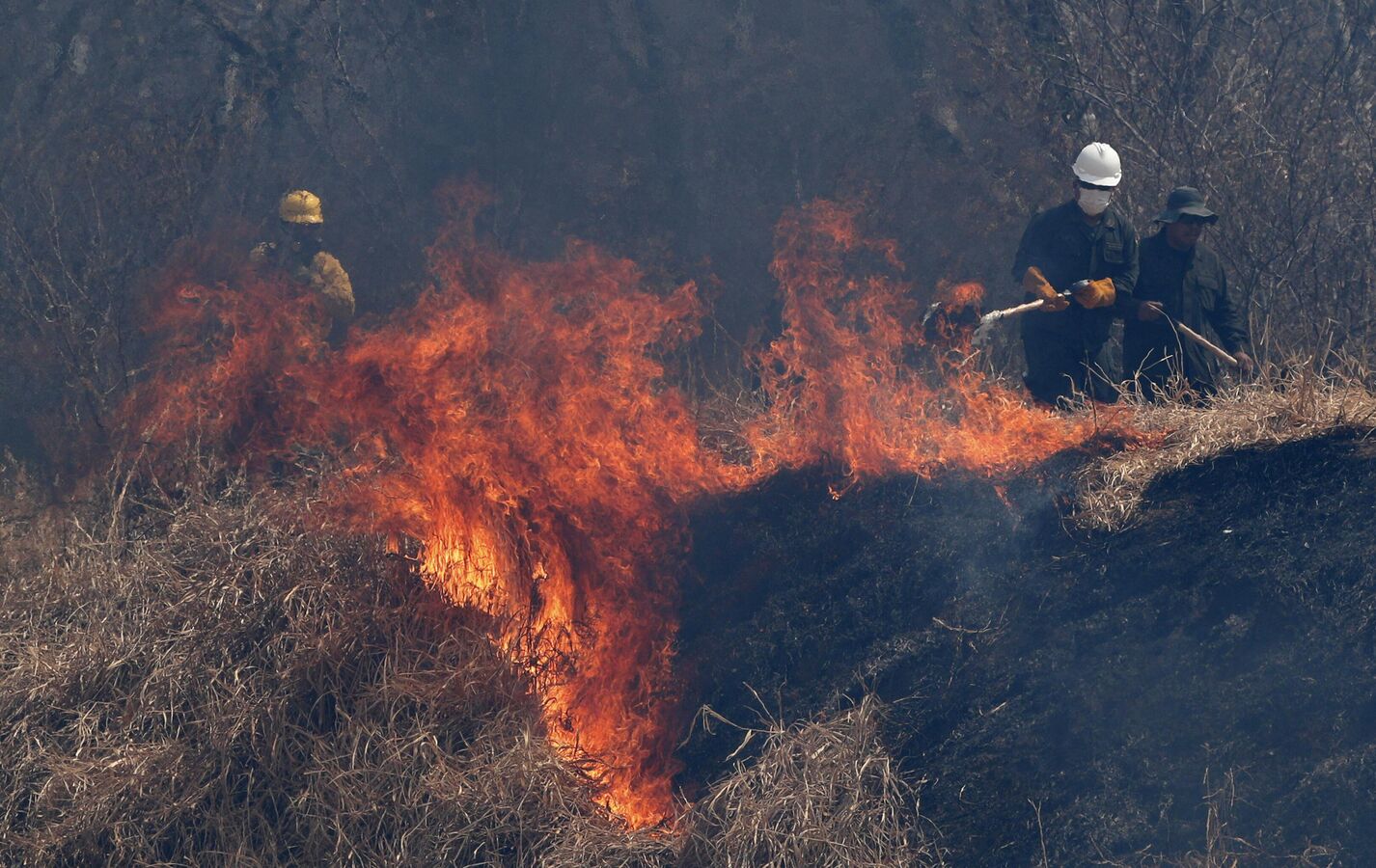
A forest fire near the town of San José de Chiquitos, in eastern Bolivia, has grown past 8,000 hectares, about 20,000 acres, and is moving south toward two protected areas. The Santa Cruz regional government says it is the largest of six fires now burning in the department.
Free daily brief — no card needed
Get every Bolivia story in one morning email
We build you a personalized brief around the topics you follow — free for 7 days. Love it? Your first month after that is US$1.
Yes, email me my free daily brief — I can unsubscribe any time.
For US readers, the fire matters as a sign of how bad Bolivia’s dry season has become, and for any traveller or business with plans in Santa Cruz, the country’s largest region. No deaths or injuries have been reported so far, and officials have not reported any damaged communities.
What Happened
Officials say the fire was first detected on Wednesday 11 November 2026 in the municipality of San José de Chiquitos. By Saturday 14 November it had passed 8,000 hectares in the rural Taperas area of the municipality.
A reconnaissance flight by Bolivia’s national disaster-response agency, the Civil Defence vice-ministry, and the Bolivian Air Force estimated the fire head at about 16 kilometres (10 miles) wide. The tail stretched 14 to 15 kilometres and the flanks about 10 kilometres, with steady movement to the south.
What Is at Risk
Officials say the flames threaten the headwaters of the San Miguel river, the Guapoy scrubland and the Tucabaca protected area, a nature reserve in the region. Regional officials also say the fire threatens Ñembi Guasu, a large protected area in Bolivia’s Chaco lowlands.
Local reports say several small farming communities lie near the fire, and none has been damaged so far. Protecting the two protected areas and the Tucabaca valley is the main aim of the response.
How Crews Are Fighting It
Santa Cruz’s regional government says an incident command post was set up on the old road to Taperas. It reports 65 personnel, eight vehicles, three drones and two rapid-attack teams, with heavy machinery cutting firebreaks.
Firefighters can drive to about 20 kilometres from the fire front and then advance on foot. Aircraft have dropped water on the flames, while heavy smoke is making the work harder.
The Mayor Weighs a Disaster Declaration
Mayor Juan Diego Caballero said on Saturday that San José de Chiquitos is weighing an imminent disaster declaration, which the municipal council would then have to promulgate. A disaster declaration is a legal step that lets local authorities spend emergency money and ask for outside help.
The mayor has also signed a decree banning all burning, including burns that had been authorised. Farmers in Bolivia routinely burn land to clear it, and those fires often run out of control in the dry months.
What It Means for You
If you have travel planned to Santa Cruz or the Chiquitania towns, expect smoke and check local advisories in the Chiquitania, the dry forest region of eastern Bolivia, because we could not confirm any flight or road closure. The fire’s main effect on global readers is environmental, and the regional government has counted 12,864 satellite heat spots, points where sensors detect fire, across Santa Cruz so far in November.
Investors in Bolivian assets should note that we found no report of damage to any company or mining site. A longer dry spell would test the response of local and national authorities.
What Is Not Known
Officials have not said what started the fire. It is also not known how fast the fire will move, because smoke and difficult terrain limit what crews can see.
No deaths or injuries have been reported in the statements we reviewed. The size of any damage inside the protected areas has not been measured.
More: Bolivia news in English, every day from The Rio Times. Read our guide to Bolivia and its neighbours in the Andes.
Frequently Asked Questions
How Big Is the San José de Chiquitos Fire?
Bolivian officials say it has passed 8,000 hectares, about 20,000 acres, as of Saturday 14 November 2026. The Santa Cruz regional government calls it the largest of six active fires in the department.
What Is a Disaster Declaration in Bolivia?
It is a legal step that lets a local or regional government release emergency funds and call for outside help. San José de Chiquitos mayor Juan Diego Caballero said on 14 November that the municipality is weighing one.
Where Is San José de Chiquitos?
It is a town and municipality in the Chiquitania region of Santa Cruz department, in eastern Bolivia. The region is a dry tropical forest area near the borders with Brazil and Paraguay.
Do the Fires Affect Travel to Bolivia?
Officials have not reported deaths or damaged communities. We could not confirm any flight or road disruption, so travellers should check local advisories.
Sources: Government of the Department of Santa Cruz, statements by spokesman Rolando Schrupp and the incident command, 14 November 2026; Municipality of San José de Chiquitos, statements by Mayor Juan Diego Caballero, 14 November 2026; Vice-Ministry of Civil Defence of Bolivia and Bolivian Air Force, reconnaissance flight as reported by regional officials, 14 November 2026.
This article was produced by The Rio Times’ automated AI newsroom. Editorial responsibility: Matthias Camenzind, Publisher and Editor-in-Chief. The Rio Times also runs Ask Rio Times, which answers from 100,000+ of our own articles, the daily Latin America Power Map, and prediction-market odds on elections and markets.. How we use AI · Report an error
The Rio Times · Power Map
See who really holds power in Latin America
Click to open the Power Map →












 English (US) ·
 French (CA) ·
 French (FR) ·