
PROTECT YOURSELF with Orgo-Life® QUANTUM TECHNOLOGY
Orgo-Life the new way to the future Advertising by AdpathwayThe Apennine Mountain Traverse is a long-weekend bikepacking route that crosses the vast forests of the Northern Italian Apennines along the quiet, timeless paths of Italy's mountain heritage. From arid, desolate ridges to ancient woodland trails, this mountain bike journey showcases a variety of unique landscapes in a relatively compact adventure…
Apennine Mountain Traverse is a mountain bike route that starts in the centre of Bologna, the heart of Emilia-Romagna, and ends in Forlì, just a few kilometres from the seaside. The route follows the Apennine ridge of the Casoni di Romagna wind farm through a stunning landscape of arid ridges, pastures, and dirt tracks leading to Pietramala, just a stone’s throw from the ancient Raticosa Pass.
The steep climbs will take you into the forested heart of the route, passing the Badia di Moscheta, one of the most important spiritual landmarks in the local mountains, founded in 1034. From there, you’ll follow forest tracks deep through vast beech forests and thrilling, fast descents perfectly suited for mountain bikes.
Several sections of the route overlap with the G.E.A. (Grande Escursione Appenninica), the historic long-distance trail created in the early 1980s. The route meets it again in the small village of Castagno di Andrea, home to the official Punto Tappa mountain hut, and later along the Monte Falco forest road. These mountains also bear the traces of the Gothic Line, the German defensive line that split Italy in two during the Second World War before being broken through by Allied forces.
At San Benedetto in Alpe, the route enters the Casentinesi Forests National Park, a vast protected area known for its ancient and remarkably well-preserved forests, among the oldest in Europe. Silent and almost entirely covered in woodland, the park is characterised by towering beech forests, chestnut groves, and endless green hills stretching towards the horizon.
In the final section, the route gradually leaves the high mountains behind, descending through the beautiful hills around Castrocaro Terme before reaching Forlì. Shortly before the finish, the trail crosses the spectacular Rio Cozzi canyon via fun, scenic singletrack that winds gently downhill between towering white rock walls and natural caves.
Route Difficulty
Overall, we give this route a 6/10. Beautiful places require a proper physical effort in the mountains. There are only moderate technical requirements, but good training is mandatory.
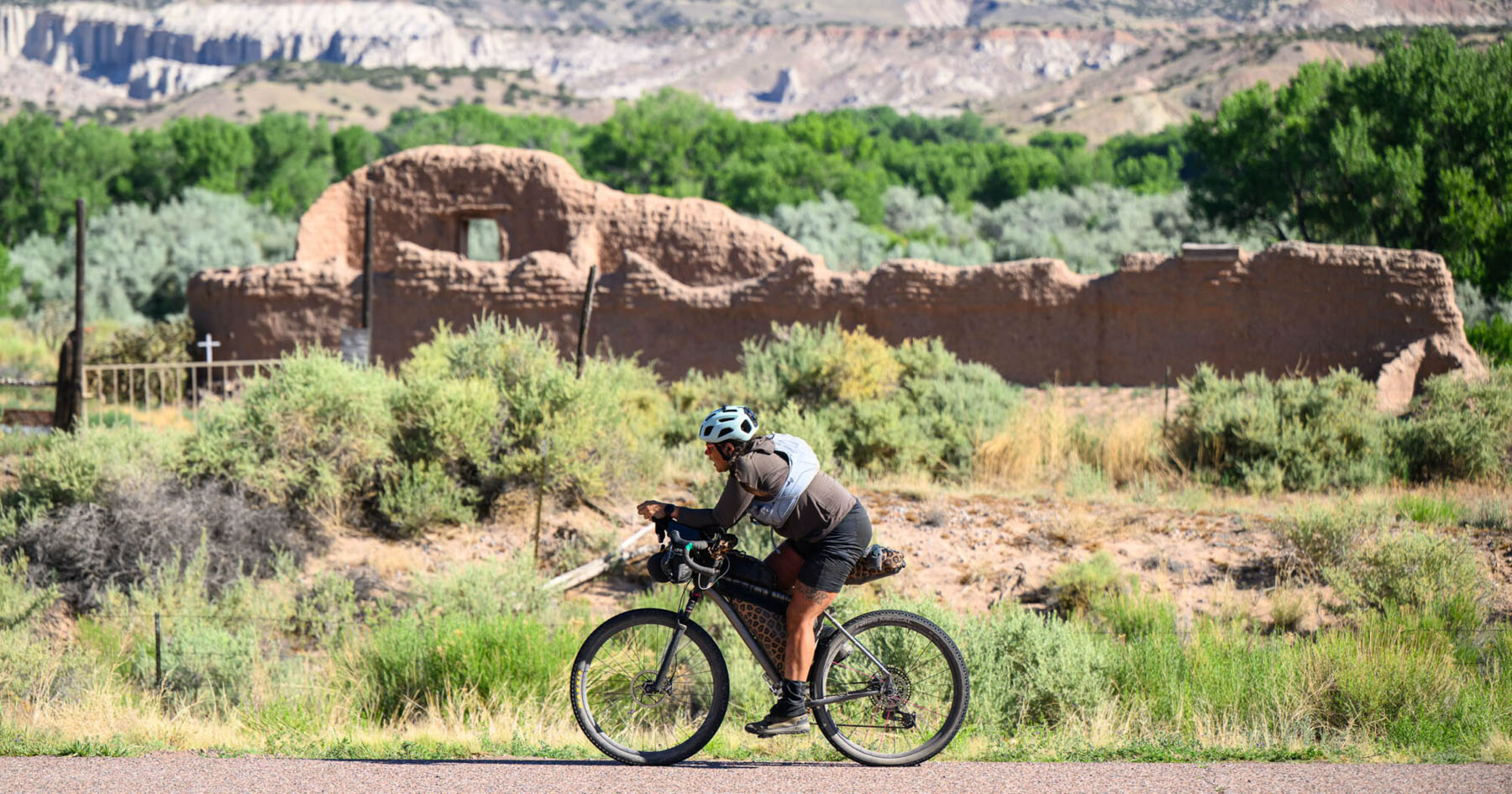
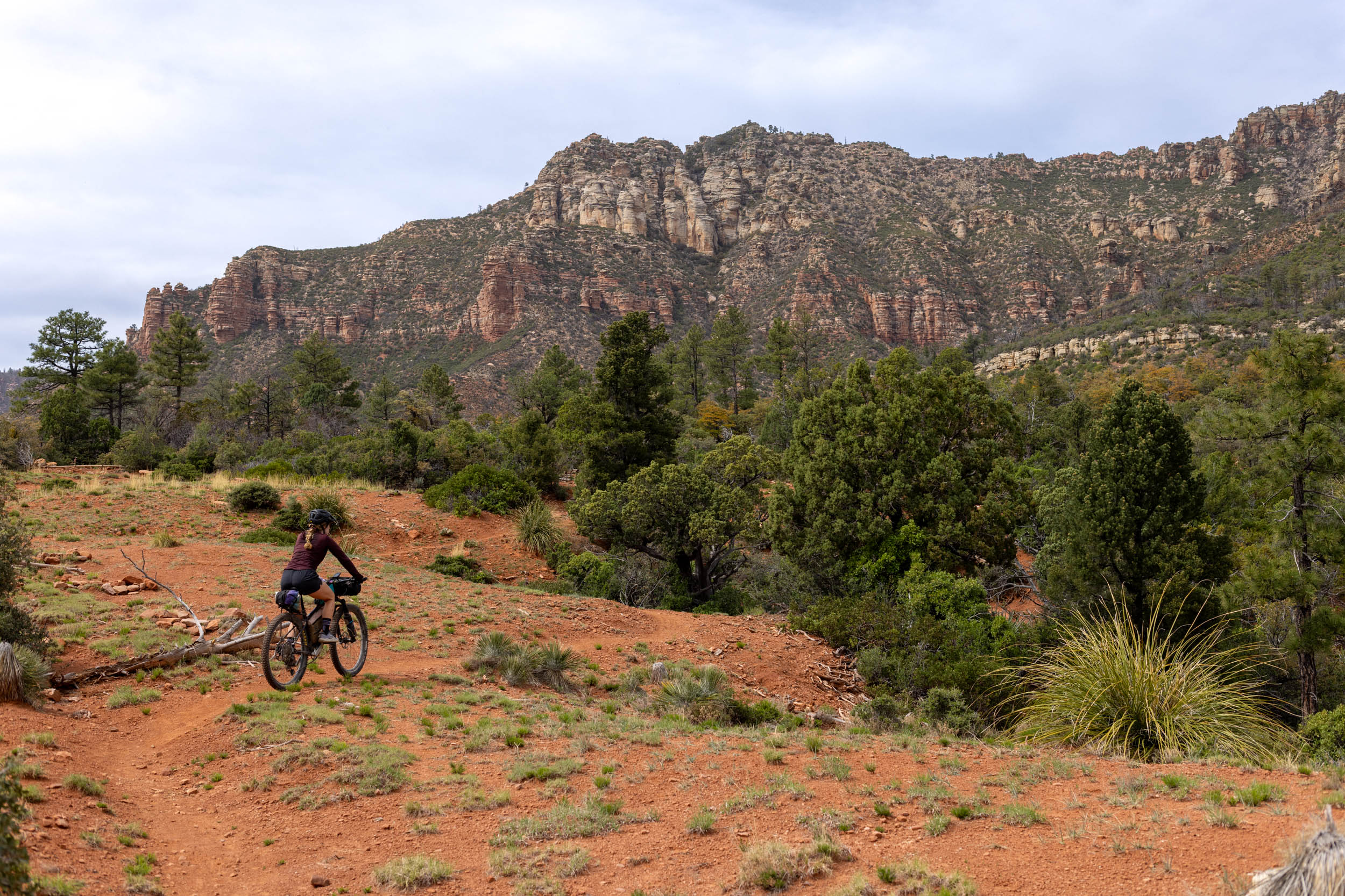
- Technical Difficulty: The route does not present any particular technical difficulties, nor does it require advanced riding skills. The off-road sections consist of singletrack and forest tracks that are easy to cycle on. Nevertheless, the only recommended type of bike is a mountain bike, as the ground is very uneven in many places. A gravel bike is strongly discouraged.
- Physical Demand: We have split the route into three days, each of which is demanding in terms of total elevation gain and the steepness of the climbs. The final day, in particular, is quite hard, with a few hike-a-bike sections in the last stage. They aren’t exactly pleasant, but they allow you to stay at altitude and enjoy some interesting descents, rather than heading down into the valley along boring tarmac roads.
- Resupply and Logistics: There are plenty of places to stock up on food and water, except in the ridge areas. Every village, however small, has at least one bar you can rely on and a public drinking fountain. The mountain section of the trail is dotted with mountain huts where you can sleep and eat. We recommend contacting them in advance as their opening times vary by season.
Route Development: The Apennine Mountain Traverse is a route we devised with the aim of spending three days mountain biking with a few friends amidst the mountains and forests of our Apennines, complete with tasty barbecues, campfires, and nights spent in tents—all things we were really looking forward to as a break from the daily grind. Enjoy!
Submit Route Alert
As the leading creator and publisher of bikepacking routes, BIKEPACKING.com endeavors to maintain, improve, and advocate for our growing network of bikepacking routes all over the world. As such, our editorial team, route creators, and Route Stewards serve as mediators for route improvements and opportunities for connectivity, conservation, and community growth around these routes. To facilitate these efforts, we rely on our Bikepacking Collective and the greater bikepacking community to call attention to critical issues and opportunities that are discovered while riding these routes. If you have a vital issue or opportunity regarding this route that pertains to one of the subjects below, please let us know:
Highlights
camera
Must Know
alert
Camping
home
Food/H2O
drop
Trail Notes
signpost
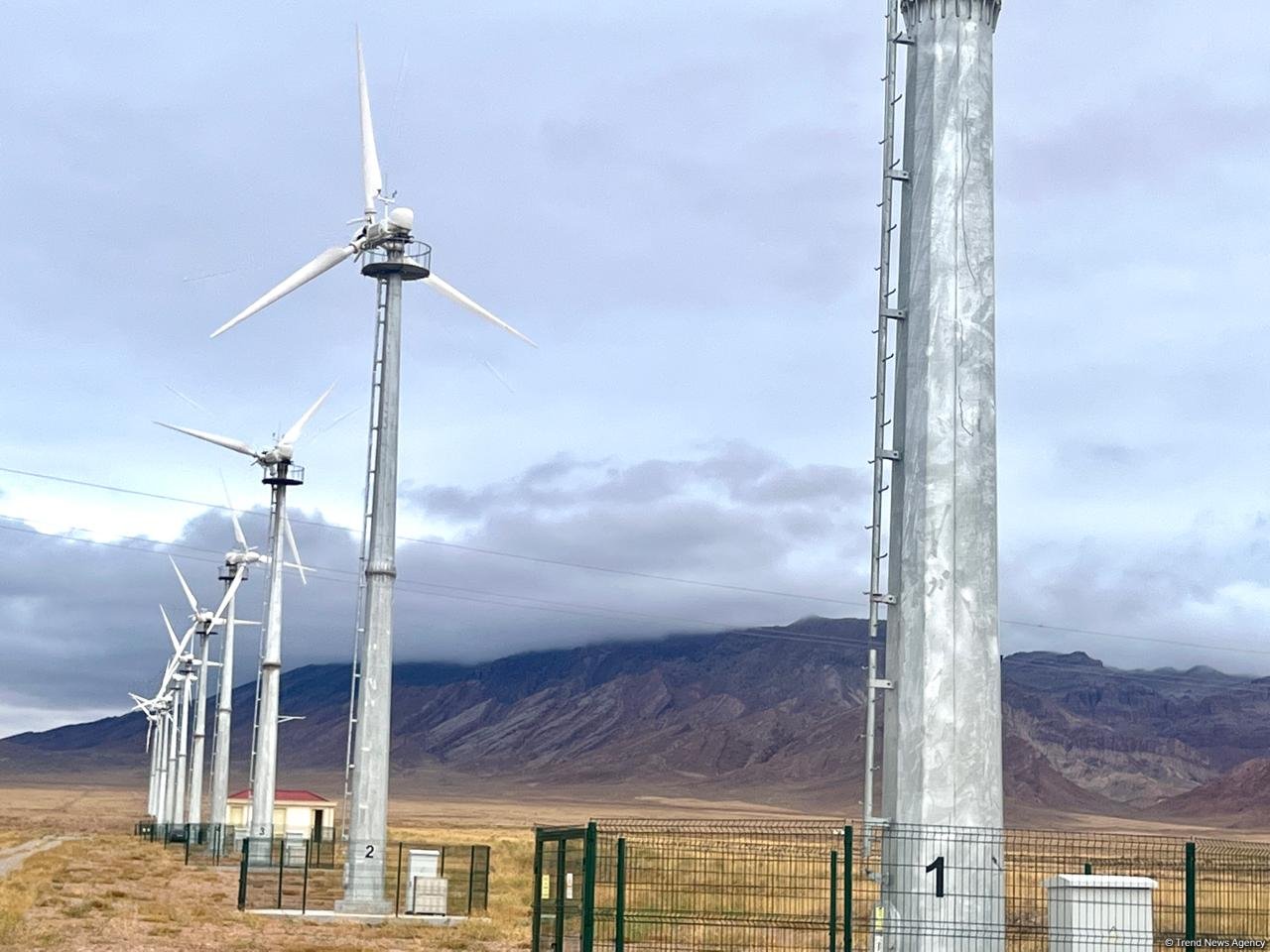
- The scenic Casoni di Romagna section: the Casoni di Romagna wind farm is situated at an altitude of 710 metres above sea level, in a stunning setting between the Idice and Sillaro valleys and close to the border with Tuscany. The doubletrack crosses the entire ridge, passing the 16 enormous wind turbines that make the surrounding barren landscape unusual and fascinating. A distinctive feature is the type of black rock found along the route: these are ophiolites, magmatic and metamorphic rocks of the oceanic crust. After the ridge, you will pass in front of the Sasso della Mantesca (Mantesca Stone), which is a black triangle shaped by nature, quite famous here, and the protagonist of many folklore legends.
- The ancient Abbey of Moscheta: founded in 1034, the Abbey of San Pietro a Moscheta stands in the heart of the Tuscan-Emilian Apennines. Its name derives from the ancient Mons Ischetus (mountain of oaks). After a period of great splendour and medieval prosperity, the building was gradually abandoned from the 14th century onwards. Today, the complex also houses the Museum of the Historic Landscape of the Apennines.
- The Raticosa Pass: the Raticosa Pass is situated at 968 metres above sea level. It is a famous pass in the Tuscan-Emilian Apennines, located between the provinces of Bologna and Florence (in the municipality of Firenzuola). The pass is renowned for its nature trails and is a much-loved destination for motorcyclists and cyclists. It was crossed by the Giro d’Italia in 1934 on the route from Florence to Bologna.
- The natural landscapes of the Casentinesi Forests National Park: the Casentinesi Forests National Park boasts one of the most unspoilt and picturesque forest landscapes in Europe: vast beech woods, ancient fir forests, and deep valleys shape an Apennine environment characterised by ridges, streams and rocky cliffs.
- The hilly area of Castrocaro Terme and Forlì: the hilly area of Castrocaro Terme features a landscape typical of Romagna, with vineyards, woods, and gentle Apennine slopes. The area is crossed by the Via Romea Germanica and the Cammino di Sant’Antonio, ancient medieval pilgrimage routes. The badlands are the typical clay formations shaped by water erosion, which create striking scenery that breaks the green hills around.
- The wild Rio Cozzi Canyon: it is one of the most striking examples of erosion in the region. You will ride beneath enormous blocks of whitish clay known as ‘spungone’, which line the whole course of the Rio Cozzi stream.
- When to go: from April to October. Mild nights, hot days. May-June would be the best choice. April and October may be possible, although the nights could be very cold.
- Logistics: Bologna and Forlì are well connected by all modes of transport: flights, motorways, and trains. You can set off from Bologna by train, travel to Forlì, and return by train. The journey takes about an hour and a half.
- What bike: We suggest riding that route with a mountain bike or monster cross bike due to the nature of the road and singletracks. A rigid or suspension front fork will work, and the minimum recommended tire size is 2.25″.
- Free (wild) camping is forbidden. We recommend getting in touch with the locals and asking for a place. If you are a small group of few people and are riding the route during the off-season, it will be easy to put up the tent discretely in places. Otherwise there are plenty of mountain huts, hotels or hostels where you can find a room.
- There is a free campsite before reaching Moscheta Abbey, perfect for the first Night (with a barbecue area!)
- Despite the possibility of discrete camping in other places, wild camping is strictly forbidden among the “Parco delle Foreste Casentinesi” because it’s an environment preservation area. There you can find many forest cabins and refuges. As previously mentioned, for some of them it’s suggested to call the owners in advance.
- You can find many markets and shops in almost every town along the route.
- You can use the public grill areas in Moscheta Abbey campsite (km 71) or 6 km after, at the “Rifugio la Serra”; be sure to buy food before in Idice Valley town shops or in Firenzuola. Leave the place in better condition than you found it.
- There is a restaurant in the Moscheta Abbey (check for open hours and days)
- In “Castagno d’Andrea” village there’s a hut – an official stop on the GEA route. Ask the local ARCI Bar to secure a bed there.
- Water is widely available along the entire path, including from fountains. Some of them may not be monitored, but we promise they provide very good, fresh water.
- We highly recommend Bar Caffè Falterona in Castagno d’Andrea; they offer great food at fair prices, and the staff is incredibly friendly and welcoming.
We have split the route into three days:
location Bologna – Badia di Moscheta
Day 1 (71km, 1,600m)
Day 1 begins by climbing into the Apennines across a mountain ridge overlooking Idice and Sillaro Valley.
location Badia di Moscheta – Il Castagno d’Andrea
Day 2 (60km, 1,400m)
Starting with a hard climb followed by a fun downhill on a forest road, you will reach the “Mugello,” a famous Tuscan valley. After that, the longest and most challenging climb of the entire route awaits you.
location Il Castagno d’Andrea – Forlì
Day 3 (96km, 2,200m)
The most panoramic and demanding stage. First, you will cross the amazing Casentino forest, where the landscape views are stunning. Then, there are a few hike-a-bike sections that allow you to stay at altitude and enjoy some exciting descents and singletrack. There is a landslide in the middle of this stage, but don’t worry. It’s easy to cross on foot.
Keep in mind that the off-road section before Pietramala can become extremely muddy after heavy rain. In such conditions, allow for up to an hour of hike-a-bike, or consider bypassing the section entirely by following the paved road from Monterenzio to Pietramala.
If needed, there is a railway station in Borgo San Lorenzo. From there, you can access Forlì, the end of the route, in around two hours with one change. Florence is approximately 45 minutes away, and Bologna is about 1 hour and 45 minutes.
Terms of Use: As with each bikepacking route guide published on BIKEPACKING.com, should you choose to cycle this route, do so at your own risk. Prior to setting out check current local weather, conditions, and land/road closures. While riding, obey all public and private land use restrictions and rules, carry proper safety and navigational equipment, and of course, follow the #leavenotrace guidelines. The information found herein is simply a planning resource to be used as a point of inspiration in conjunction with your own due-diligence. In spite of the fact that this route, associated GPS track (GPX and maps), and all route guidelines were prepared under diligent research by the specified contributor and/or contributors, the accuracy of such and judgement of the author is not guaranteed. BIKEPACKING.com LLC, its partners, associates, and contributors are in no way liable for personal injury, damage to personal property, or any other such situation that might happen to individual riders cycling or following this route.
Further Riding and Reading
Here are some connected/nearby routes and related reports...
Please keep the conversation civil, constructive, and inclusive, or your comment will be removed.


 English (US) ·
  French (CA) ·
  French (FR) ·