
PROTECT YOURSELF with Orgo-Life® QUANTUM TECHNOLOGY
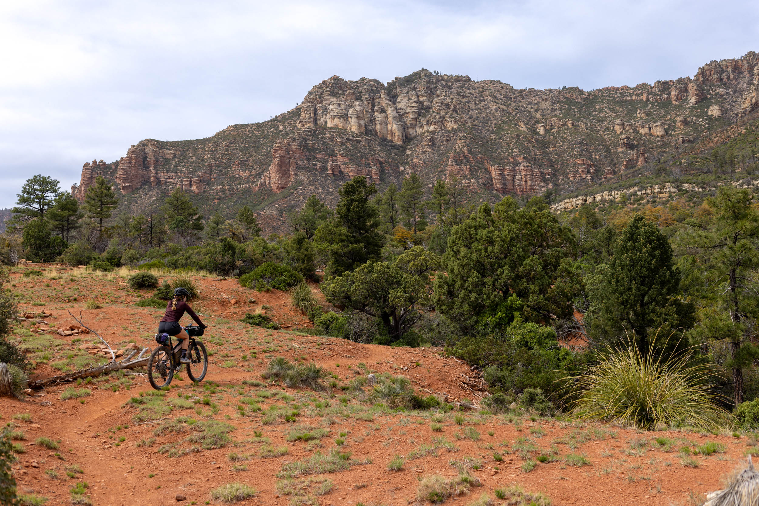
Orgo-Life the new way to the future Advertising by AdpathwayThe 212-mile Steel Triangle bikepacking route connects rail trails and gravel through Western Pennsylvania’s reborn forests and enduring industrial heart, where forgotten furnaces and bridges tell the story of coal, steel, and resilience. Riders flow from the gentle, river-hugging Great Allegheny Passage to the remote, rugged heights of Laurel Ridge, then back through a network of remote rail trails and small towns—an accessible yet soulful journey that balances history, wilderness, and adventure…
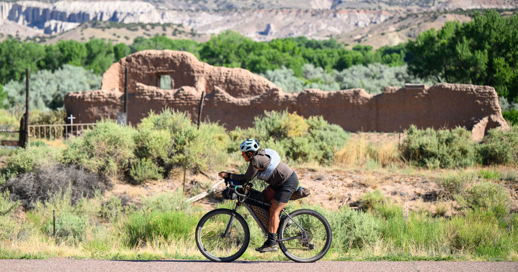
Western Pennsylvania is a region defined by its rugged terrain, rich industrial heritage, and a deep, collective devotion to the Pittsburgh Steelers. Historically a powerhouse of American industry, the area was built on the bedrock of coal and steel, its landscape dotted with the former company towns that once fueled the nation’s progress. While the era of massive mills has largely passed, travelers on the Steel Triangle Route can still find compelling traces of this industrial past. Along the path, relics such as mid-19th-century coke ovens and blast furnaces—once crucial to producing pig iron—stand as silent monuments to a bygone age.
Remarkably, the lush forests that blanket the state of Pennsylvania today are a testament to nature’s resilience, having rebounded dramatically after being almost entirely clear-cut by the early 1900s to support the insatiable demands of the Industrial Revolution. The region’s natural splendor was even highlighted by Rebecca Harding Davis, a pioneer of literary realism, who beautifully captured its essence: “Nowhere in this country, from sea to sea, does nature comfort us with such assurance of plenty, such rich and tranquil beauty as in those unsung, unpainted hills of Pennsylvania.”
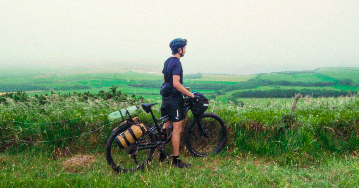
The Steel Triangle Route is designed as a dynamic adventure, with each side offering a distinct experience. For those new to bikepacking, this loop route provides an ideal entry point. It features a flexible starting location, easy resupplying in local towns, many camping options, and predominantly non-technical riding surfaces.
The western side of the triangle encompasses 67 miles along the renowned Great Allegheny Passage (GAP). This well-established rail trail follows the former paths of the Western Maryland Railway and the Pittsburgh & Lake Erie Railroad along the stunning Youghiogheny River and through small towns established during the heyday of those rail lines. While riding on the trail, you’ll experience the beauty of the region, traveling between the rail town communities and enveloped in a lush green tunnel of trees, rhododendron, and plant life critical to the regional ecosystem.
In sharp contrast, the eastern side of the triangle features Laurel Ridge, a 67-mile stretch along the most challenging and remote segment of the 212-mile trip. This section involves significant climbing along the ridgeline, rewarding riders with an experience of untraveled gravel roads and elevations reaching up to 2,800 feet. Up here, the environment shifts dramatically as you traverse multiple state game lands, state parks, and the vast Forbes State Forest, all primarily on unpaved surfaces. Along this quiet, high-elevation ridgeline, you will discover the serene beauty of the rolling hills, vistas, and historic structures, including two preserved iron furnaces and Civilian Conservation Corps (CCC) infrastructure like the historic Jones Mill Run Dam.
Finally, the northern side of the triangle covers approximately 78 miles, using a mix of three rail trails (The Westmoreland Heritage Trail, the West Penn Trail, and the Ghost Town Trail) and paved roads, with one brief set of stairs. This segment is characterized by quieter rail trails that see significantly less traffic than the GAP. You will move between these trail sections via connector roads, appreciating the unique character of each rail trail and the subtle challenges this diverse landscape presents.
Route Difficulty
Generally speaking, this route is doable in a long weekend if you have pretty good fitness and endurance. It’s as approachable for beginners as they come, with almost 50% of the route on rail trail, but beware that there are still some steep climbs over 12% and one hike-a-bike up some steep stairs. That said, there is nothing too technical, and it is 99% rideable, though some state-owned roads can have fairly rough surfaces with loose, chunky gravel at times. One other consideration is the distance between camping options on the northern side of the route. In that respect, the northern side is extremely limited, with only one camping option available. Make sure to delve into the Camping and Must Know tabs below for careful consideration.
Route Development: After completing my first bikepacking trip from Washington, D.C., to Pittsburgh along the C&O Canal and GAP trails, I felt a sense of excitement and a need to broaden my horizons. My passion for mapping and navigation quickly evolved into an obsession with local geography. For months, I pored over topographical maps of Western Pennsylvania, seeking to bridge the gaps between disconnected trails. Ultimately, I successfully stitched together the GAP, Ghost Town, West Penn, and Westmoreland Heritage trails with some of the rugged public lands of the Laurel Ridgeline to forge my first original route.
Submit Route Alert
As the leading creator and publisher of bikepacking routes, BIKEPACKING.com endeavors to maintain, improve, and advocate for our growing network of bikepacking routes all over the world. As such, our editorial team, route creators, and Route Stewards serve as mediators for route improvements and opportunities for connectivity, conservation, and community growth around these routes. To facilitate these efforts, we rely on our Bikepacking Collective and the greater bikepacking community to call attention to critical issues and opportunities that are discovered while riding these routes. If you have a vital issue or opportunity regarding this route that pertains to one of the subjects below, please let us know:
- Taking a sidequest to the Ferncliff Nature Area in Ohiopyle State Park; a unique habitat with many rare and unusual, for Pennsylvania, plants
- Utilizing the stairs in McKeesport; While you could always just ride down the road, It wouldn’t be an adventure in Western PA without a set of stairs.
- Take a short side trip to hike to Buttermilk Falls, one of the tallest falls in Pennsylvania
- Stopping by one of the many water sources for a swim; including Cranberry Glade Lake, Laurel Hill Lake, or the Youghiogheny River.
- Camping at one of the Laurel Highlands hiking trail shelters
- Taking in the view of the Spruce Flats Bog, a rare high elevation bog containing highly acidic soil and with it unique plants including carnivorous plants like the insect-eating pitcher plant and sundew.
- Catching views of historical landmarks such as the Laurel Hill Furnace, Jones Mill Run Dam, Air Glow Laboratory, and Connelsville Coke Ovens
- Taking in the scenic overlook at Laurel Hill State Park
- Trout fishing in some of the state’s least fished streams; see the extras/additional resources section for a state produced resource that will help you identify the best areas to fish.
- Stopping by Tissue Farm in Confluence, PA for some coffee, pastries, and the art gallery
When to go
- This route is rideable all year, but the best time is spring or late summer before hunting season begins.
Logistics
- For traveling by car, the Great Allegheny Passage (GAP) or the Laurel Highlands Hiking Trail (LHHT) areas. Multiple parking areas allow overnight parking and give you flexibility on where you can start and end your trip, especially when taking into account camping options and daily mileage.
- For traveling by train, Amtrak offers bicycle service on its Floridian line (a temporary merger of its Capitol Limited and Silver Star routes) which runs between Chicago and Washington, D.C., with stops along the Great Allegheny Passage in Downtown Pittsburgh, Connellsville, and Cumberland. For an extra $20 on top of your regular fare, you can secure your bicycle in a retrofitted baggage car and get on or off at any station. Currently, each train has room for six (6) bicycles with a 2” tire maximum clearance. You must purchase and reserve your ticket and one of six bicycle slots ahead of time.
- This loop is best completed counterclockwise, read more about why in the Danger and Annoyances Section.
- Access to Laurel Highlands Hiking Shelters: Each shelter has a gravel access road that rangers utilize to patrol the shelter/campsite areas and they can be seen on the RidewithGPS platform. Please be certain to utilize the roads, in a pinch if you can’t locate one of the access roads, you could hike your bike in on the Laurel Highlands Hiking Trail.
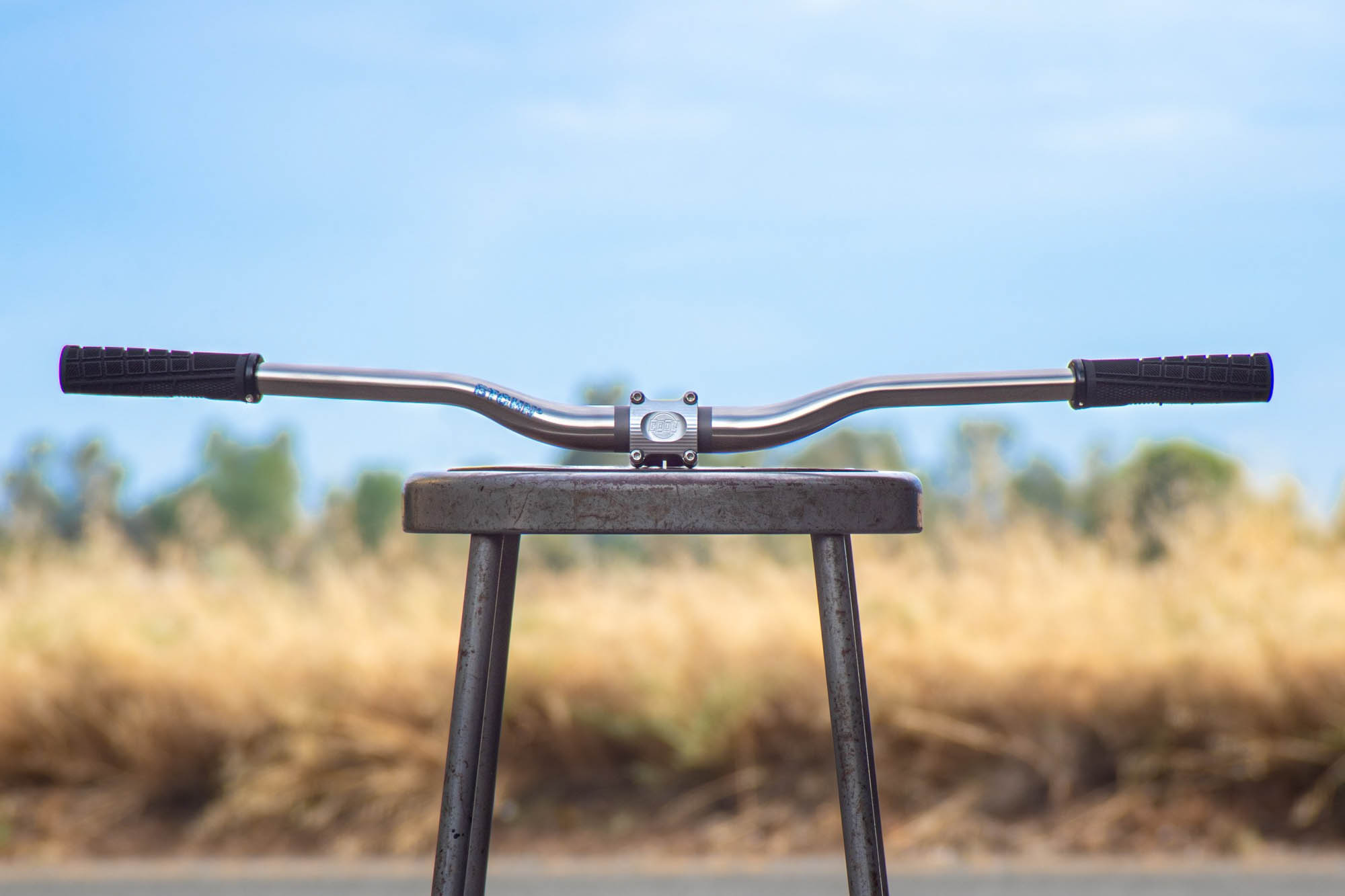
What bike?
- As mentioned in the route difficulty section, there are a handful of steep climbs through this route once you get to the Laurel Ridgeline. They are often relatively short, but the cumulative effect of many in a row is notable. We recommend forgiving gearing or accepting that you might be hiking up a few hills.
- Fast-rolling, 32mm gravel rubber would be a good choice for this ride. As mentioned above, a good portion of this route is a mix of rail trail and paved road. The gravel road portions on this route are in relatively good shape so you shouldn’t need anything too burly.
- There aren’t too many bike shops on route. Once you get off of the Great Allegheny Passage don’t expect a lot of options on this route without getting a hitch from someone so bring some extra tubes.
Dangers & Annoyances
- While much of this route uses rail trails, gravel and relatively low-traffic roads, the 11 mile road section between Trafford, PA and Boston, PA utilizes some heavily trafficked roads. The route was purposely built to go counterclockwise in order to keep most of those busy road sections downhill.
- Private Land Issue: When crossing RT 30 and turning onto Ridgeview Road, a short while down the road you will run into an intersection where a “No Trespassing” sign is. After reaching out to the Chief Ranger of the Laurel Ridge State Park he has verbalized that there is a public right of way via a 2 mile section of Ridgeview Road, which later connects to Laurel Ridge State Park and PA State Game Lands. If you see a landowner on the road be certain to give them plenty of space, and wave a friendly hello. The Ranger noted that if there is a negative landowner interaction that you should deescalate the situation turn around and return to route 30 where you can call the State Park Office (+1 814-445-7725) first or if needed the Chief Ranger’s cell phone (+1 814-490-7520) to ask for assistance, if an emergency please dial 911. The other note he had was that the landowners specifically had issues with snowmobiles and four wheelers on the road so they have been taking things into their own hands by placing multiple “No Trespassing” signs along Ridgeview Road to scare people. See this alternative route option on RideWithGPS to avoid this 2-mile stretch.
- The Great Allegheny Passage (GAP) is a 150 mile rail trail stretching from Pittsburgh, PA to Cumberland, MD. This route includes ~67 miles of the passage, which has a plethora of camping options. The campsite I most enjoy stopping at is the Cedar Creek Campground due to it being a biking/hike in camp area with access to free fire wood at campsites and water access to the Youghiogheny River. You can find more details on these campsites at the Great Allegheny Passage website.
- The Laurel Highlands Hiking Trail Shelters offer a secluded experience that typically only backpackers experience, but thanks to public access roads this route is able to take advantage of them. Please be certain to book a site on the PA Department of Conservation and Natural Resources website. Check out the Instructions here and make reservations here at the PA DCNR Reservation Website.
- The Bush Recreation Campground at Loyalhanna Lake is a necessity. Unless you plan to ride the 100 mile gap in between the nearest Laurel Highlands Shelter Area and GAP campground. Thankfully they have hot showers available so it’s not all bad.
- Forbes State Forest allows primitive camping without a permit if staying no more than one night in any location. Please note that you may camp overnight anywhere except: In designated Natural Areas, within 200 feet of a forest road, within 25 feet of a trail, or within 100 feet of a stream or any open water. If you plan to utilize the state forest, I recommend downloading a map as it isn’t always clear what is state forest, private land, state game lands, or state park lands.
- No Camping is allowed on Pennsylvania State Game Lands
Food:
Other than the journey onto the Laurel Ridgeline you will find many options for food. My favorites are below:
- Coffee at Tissue Farm in Confluence, PA
- On a hot day I recommend stopping at Stiles’ Koolit Korner in Seward, PA for some ice cream and fries
- D’s Six Pax & Dogz in Murrysville, PA
Water:
- While there are plenty of options for treated water along the route, you should still bring a filter for the Laurel Ridge portion where streams and wells are untreated.
- Warning: Regardless of water filtering, don’t drink the water from Blacklick Creek, off of the Ghost Town Rail Trail. Blacklick Creek has been on DEP’s impaired waters list since its inception in 2006, impaired by mine drainage, which caused unbalanced pH and high levels of iron, aluminum, and manganese.
location Confluence, PA > US Route 30 Laurel Highlands Hiking Shelter
Day 1 (47.6 mi +5,682 ft)
Park your car at the Great Allegheny Passage – Confluence Trailhead parking lot and make your way into Confluence, PA for some coffee at Tissue Farm or some breakfast at Mitch’s Fuel & Food Restaurant. While the shortest day of the ride it’s going to be the hilliest and packed with gravel roads as you climb up into the Laurel Ridge. The first 10 miles from Confluence are climbing on a mix of pavement and gravel, but you’ll be rewarded shortly thereafter with Cranberry Glade Lake and your first opportunity for a swim or a snack break with a view. After leaving Cranberry Glade lake you’ll make your way down a gravel road that weaves through the state forest before you get spat out on a paved road to ride over the historic Barronvale covered bridge and make your way to Laurel Hill State Park where another lake awaits along with a stunning overlook, a dam built during the CCC era and some fly fishing opportunities. The remainder of the day you’ll be weaving multiple public backroads, including state parks, state forests, and a hiker/snowmobile bridge crossing the PA turnpike before arriving at a relatively busy road crossing over the Laurel Highlands, US 30. When searching for the access to the Laurel Highlands US 30 Shelters it’s just a short ¼ of mile down the road on what turns out to be the driveway to an abandoned house. There shouldn’t be anything obstructing the driveway, but if you are struggling to find the entrance I suggest looking for the Laurel Highlands Hiking Trail and hiking your bike down that until you get to the shelters.
location US Route 30 Laurel Highlands Hiking Shelter > Loyalhanna Lake (Bush Campground)
Day 2 (55.2 mi +4,476 ft)
Your day will start with a choice, as mentioned in the Danger & Annoyances section, Ridgeview Road is public, but the landowners have apparently been annoyed with snowmobilers/4 wheelers. I’ve traveled the road a few times on bike and seen landowners each time and never had any issues. As I mentioned, if you have any issues, descalate, turn back and call the Chief Ranger of Laurel Ridge State Park or use the alternate route that can be found in the Danger & Annoyances Section or the Extra/Additional Resources Section. Once you are through that section you’ll be traversing gravel/dirt roads on public lands for most of the remainder of the riding on the Laurel Ridge until you descend into Seward, PA and finish your time on the Laurel Ridgeline. Once you get into Seward you can choose to restock supplies at the Ideal Mart/Dollar General or grab some food at Stiles’ Koolit Korner. From there you’ll begin a climb up from Seward towards Route 22. If you are feeling up for a sidetrip make sure to stop off at Buttermilk Falls and take a hike to see this unsuspecting waterfall. Once you reach Route 22 you’ll want to take care when crossing as the highway can be busy at times but still crossable. Across the road you’ll notice that the road dead ends shortly after crossing the highway and that there is a hill shortly after the road ends. While they’ve closed the road crossing, there is still legal right away to cross, I recommend hiking your bike and hugging the side of the hill until you get to the other side and can connect to the other side of the Bethel Cemetery Road and begin a great descent down to the Ghost Town Rail Trail. From there you will take the Ghost Town Rail Trail into Black Lick, PA where you’ll have a road ride to connect you to the West Penn Rail Trail and one of the more uniquely challenging sections that will require you to unload your bike and push your bike up a set of steep stairs to help get you around the Conemaugh River Dam before you can make your way down to camp at the Loyalhanna Lake – Bush Campground
location Loyalhanna Lake – Bush Campground > Cedar Creek Campground
Day 3 (61.5 mi +3,071 ft)
Once you leave the Loyalhanna Lake – Bush Campground you’ll begin your day with a steep climb to get you back onto the West Penn Rail Trail, if you are feeling the need for a breakfast after that climb you should stop into Saltsburg. From there it should be smooth sailing as you connect the West Penn Trail to the Westmoreland Heritage Trail with a short road ride. Along the Westmoreland Heritage Trail you can expect many options to resupply food or grab a lunch from one of many restaurants near the trail. Once you get to Trafford, PA the Westmoreland Heritage Trail will officially end and you begin the 11 mile road ride to get to Boston, PA where you will join back up with the Great Allegheny Passage. Be cautious during this section as you will see the busiest road riding of this route.
location Cedar Creek Campground to Confluence, PA
Day 4 (49 mi +1,357 ft)
With your final day all along the Great Allegheny Passage, expect smooth sailing and easy miles. If you are riding this during the summer or early fall you’ll have many options along the way for food, beer, and other refreshments. If it’s a hot summer day I recommend taking a break in Ohiopyle to enjoy a dip in the Youghiogheny River at the Ohiopyle State Park.
Terms of Use: As with each bikepacking route guide published on BIKEPACKING.com, should you choose to cycle this route, do so at your own risk. Prior to setting out check current local weather, conditions, and land/road closures. While riding, obey all public and private land use restrictions and rules, carry proper safety and navigational equipment, and of course, follow the #leavenotrace guidelines. The information found herein is simply a planning resource to be used as a point of inspiration in conjunction with your own due-diligence. In spite of the fact that this route, associated GPS track (GPX and maps), and all route guidelines were prepared under diligent research by the specified contributor and/or contributors, the accuracy of such and judgement of the author is not guaranteed. BIKEPACKING.com LLC, its partners, associates, and contributors are in no way liable for personal injury, damage to personal property, or any other such situation that might happen to individual riders cycling or following this route.
Further Riding and Reading
Here are some connected/nearby routes and related reports...
Please keep the conversation civil, constructive, and inclusive, or your comment will be removed.


 English (US) ·
  French (CA) ·
  French (FR) ·