

 10 hours ago
5
10 hours ago
5
PROTECT YOURSELF with Orgo-Life® QUANTUM TECHNOLOGY
Orgo-Life the new way to the future Advertising by AdpathwayGravel Challenge Across Switzerland is a 1,000-kilometer bikepacking route stretching from Geneva on the shores of Lake Léman to Morcote on the banks of Lake Lugano. With nearly 19,000 meters of climbing, the route crosses all four of Switzerland’s linguistic regions, threading through alpine passes, turquoise lakes, rolling pastures, and postcard-perfect villages…
Gravel Across Switzerland is a self-supported bikepacking challenge that takes riders on a sweeping diagonal across one of Europe’s most spectacular countries. Starting in Geneva, on the western shores of Lake Léman, the route winds nearly 1,000 kilometers east and south to Morcote, a jewel of a village perched on the shores of Lake Lugano in Ticino. Along the way, riders traverse all four of Switzerland’s linguistic regions—French, German, Romansh, and Italian—experiencing a rich tapestry of cultures, cuisines, and landscapes.
The journey begins along the gentle lakeside paths near Lausanne before climbing into the first foothills around Châtel-Saint-Denis and Gros Plané, then descending into the emblematic Gruyère region, famous for its cheese and medieval charm. The scenery steadily becomes more alpine as the route passes through Fribourg and Bern, Switzerland’s laid-back capital, before opening onto the peaks surrounding Thun and Interlaken, where turquoise lakes sit framed by snow-capped summits.
The heart of the route is a succession of legendary mountain passes: Brünig Pass, Pragel Pass, Kunkel Pass, and Schwägalp—names that evoke effort, solitude, and the reward of breathtaking panoramas. Between these climbs, riders discover the lakeside elegance of Lucerne, the rolling green hills of Appenzell, the historic streets of Chur (Switzerland’s oldest city), and the high-altitude resort town of Davos. The suspended lake of Lai da Vons offers a moment of pure alpine magic before the route reaches the San Bernardino Pass, gateway to the south.
The descent into Ticino brings a radical change of atmosphere. Mediterranean vegetation replaces alpine meadows, palm trees line shaded alleys, and the dolce vita spirit of Lugano beckons. The final stretch to Morcote feels like arriving in another country entirely—a fitting conclusion to a route that spans the full breadth of Swiss diversity.
Inspired by the Tourmagne Challenge in France, Gravel Challenge Across Switzerland was designed as a free, non-competitive adventure open to all gravel enthusiasts. With 19,000 meters of elevation gain across varied terrain—from smooth gravel roads to rugged mountain trails requiring occasional hike-and-bike—this route demands fitness, self-reliance, and a sense of adventure. In return, it rewards riders with an unparalleled immersion into Swiss nature, culture, and history.
Route Difficulty
Most of the riding is on gravel roads and forest tracks with varied surfaces, including compacted gravel, uneven dirt roads, and some non-technical singletrack on mountain approaches. Several pass sections (particularly Pragel Pass and Kunkel Pass) feature rocky, steep trails that require confident bike handling and occasional hike-and-bike, pushing this above a purely gravel route. However, there is no truly exposed or technical singletrack riding. The trails are well-marked but can be slippery when wet.
The route’s defining challenge is its physical demand (8/10). With nearly 19,000 meters of climbing spread over roughly 1,000 kilometers, the climbing is comparable to routes like the Oregon Timber Trail or the Wolf’s Lair in Abruzzo. Riders face sustained daily efforts that accumulate over 10 or more days, with several days featuring over 2,000 meters of elevation gain. The altitude—reaching above 2,000 meters at San Bernardino Pass—adds another layer of difficulty. Resupply and logistics (3/10), however, are Switzerland’s strong suit: this is a linear route from Geneva to Morcote, but both endpoints are well served by international rail and air connections. Resupply points are never far apart, water fountains are abundant throughout the country (and drinkable unless marked otherwise), and the excellent Swiss public transport network provides easy bail-out options at almost any point.
Route Development
I created Gravel Challenge Across Switzerland, a Swiss gravel enthusiast, and organize it through gravelxswiss.ch. The route was inspired by the Tourmagne Challenge, a similar 950-kilometer gravel bikepacking adventure across France created by Matthieu Brunet. I scouted and developed the entire route using Komoot, carefully selecting a line that maximizes gravel and off-road riding while linking Switzerland’s most spectacular landscapes. The route was finalized in late 2025 after extensive scouting and testing, with input from early challengers whose feedback helped refine sections for safety and ridability. The challenge launched as a free, open adventure in the spirit of community-driven bikepacking.
Submit Route Alert
As the leading creator and publisher of bikepacking routes, BIKEPACKING.com endeavors to maintain, improve, and advocate for our growing network of bikepacking routes all over the world. As such, our editorial team, route creators, and Route Stewards serve as mediators for route improvements and opportunities for connectivity, conservation, and community growth around these routes. To facilitate these efforts, we rely on our Bikepacking Collective and the greater bikepacking community to call attention to critical issues and opportunities that are discovered while riding these routes. If you have a vital issue or opportunity regarding this route that pertains to one of the subjects below, please let us know:
- Departing from Geneva with views over Lake Léman and the Jet d’Eau
- Riding through the UNESCO-listed Lavaux vineyard terraces above Lausanne
- The Gruyère region: medieval castle, rolling pastures, and world-famous cheese
- Crossing through Bern, Switzerland’s charming federal capital
- The turquoise twin lakes of Thun and Brienz framed by the Bernese Alps
- Brünig Pass: a classic Swiss alpine crossing between the Bernese Oberland and central Switzerland
- Lakeside riding along the shores of Lake Lucerne with dramatic mountain reflections
- Pragel Pass: a wild, remote crossing through pristine alpine wilderness
- The green rolling hills and traditional farmhouses of Appenzell
- Kunkel Pass: a hidden gem connecting the Rhine Valley to Chur, Switzerland’s oldest city
- Schwägalp and the panoramic views of the Säntis massif
- The suspended alpine lake of Lai da Vons near Davos
- San Bernardino Pass (2,065 meters): the gateway from the Grisons to Ticino
- The dramatic descent into Ticino with its Mediterranean vegetation and Italian-speaking culture
- Finishing in Morcote, one of Switzerland’s most beautiful lakeside villages on Lake Lugano
When to go
- The route is generally rideable from end of May to mid-October, as it climbs above 2,000 meters on mountain passes without snow clearing. The ideal window is mid-June to mid-September for the most reliable conditions.
- Registration: The challenge is free, and there is no set date. Register on gravelxswiss.ch and choose your start date. The GPX track is sent a few days before departure, updated with the latest trail conditions.
Logistics
- Getting to the start: Geneva is served by Geneva Airport (GVA) and excellent rail connections (Geneva Cornavin station). Getting back from Morcote: ride back to Lugano, then train back to Geneva or your home city via the Gotthard route.
- No permits required. Switzerland is open for cycling, but respect local rules on wild camping and stay on marked trails in protected areas.
- Navigation: The route was scouted using Komoot. The free SwissTopo app is also excellent for detailed Swiss maps. A personal GPS device is required to validate the challenge.
- Public transport bail-out: Switzerland has one of the world’s best public transport networks. Train stations and PostBus stops are never far from the route, making it easy to stop or skip a section if needed.
Travel Basics
- Switzerland is expensive: expect at least 20–25 CHF for a simple restaurant meal and around 100 CHF for a hotel. Migros and Coop supermarkets are found even in small towns and offer more affordable food options.
- Currency: Swiss Franc (CHF). Credit cards are widely accepted, but it’s wise to carry some cash for smaller villages and mountain huts.
- Language: The route crosses four linguistic regions (French, German, Romansh, Italian). English is widely spoken throughout Switzerland.
What Bike and gear
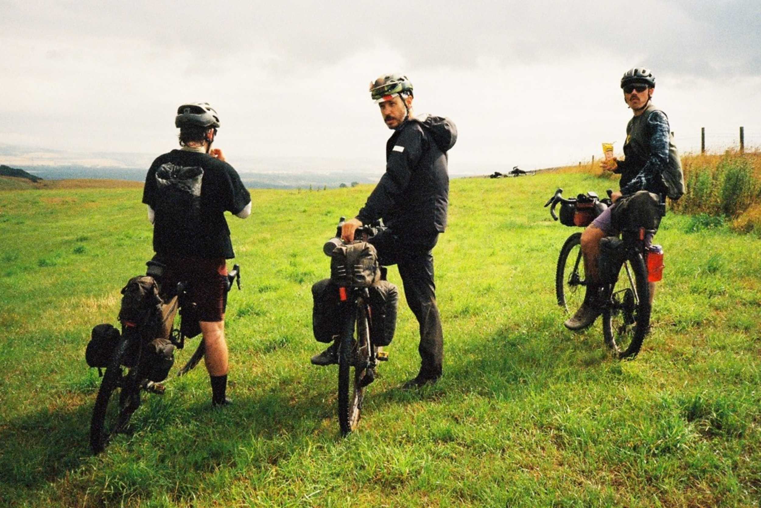
- Bike: A gravel bike with robust, wide tires (minimum 45mm recommended) is ideal. A tubeless setup is strongly advised for puncture resistance on rocky alpine trails. Low gearing is essential given the sustained climbing. Disc brakes are a must for long descents. An MTB is also suitable.
- Some sections require hike-and-bike: waterproof shoes with good grip are recommended for pushing your bike over rocky terrain.
Dangers and Annoyances
- Weather: Swiss mountain weather changes rapidly. Thunderstorms can be violent, especially in the afternoon. Install the MeteoSwiss app (available on iPhone and Android) for a highly accurate weather radar—it is the reference in Switzerland.
- Shared trails: You will often share trails with hikers. Ride respectfully, slow down around pedestrians, and avoid startling people with heavily loaded bikes.
The challenge is designed as a self-supported journey. Accommodation options include hotels (around 100 CHF/night), guesthouses (slightly less), campsites, bivouacking under the stars, or a mix of these. Wild camping in Switzerland is generally tolerated above the tree line and away from nature reserves. Still, rules vary by canton; check the Swiss Touring Club (TCS) website for current guidelines. Respect private property and always leave no trace. Temperatures can drop significantly at altitude, even in summer, so a warm sleeping bag is recommended. Towns and villages along the route offer regular accommodation options, and the route never strays too far from civilization.
- There are plenty of campsites along the route, and it will be the first step of your adventure to analyze the route and plan your days.
- Water is abundant along the route. Many public fountains are found in Swiss towns and villages. If the fountain has no warning, the water is safe to drink.
- Streams and mountain springs are also common, though filtering is recommended at lower elevations.
- Resupply is straightforward: Migros and Coop supermarkets are present even in small towns.
- For local cuisine, do not miss fondue and raclette in the French-speaking region, rösti and bratwurst in the German-speaking area, and polenta and risotto in Ticino.
- Mountain huts (Bergrestaurants) along pass routes serve hearty meals.
- Switzerland is expensive, but a baguette from Migros costs just 2 CHF, and supermarket meals are reasonable.
- Carry enough food and water for mountain pass days where resupply gaps can stretch to 40–60 kilometers.
Suggested Itinerary
Below is an approximate itinerary you could follow. The route is designed as a single continuous line, but Switzerland’s excellent public transport network allows riders to skip sections if needed. The route may be adjusted due to construction, weather, or trail conditions—the GPX file provided before departure will reflect the most up-to-date version.
locationGeneva – Gruyères
Days 1-2 (137 km, +2,490 m)
Depart Geneva along Lake Léman, passing through Lausanne and the Lavaux vineyards. Climb into the pre-Alpine foothills around Châtel-Saint-Denis and Gros Plané before descending into the Gruyères valley—mixed terrain of lakeside paths, gentle gravel climbs, and pastoral roads.
locationGruyères – Interlaken
Days 3-4 (170 km, +2,210 m)
Cross through Fribourg and Bern on a mix of gravel paths and cycle routes. The terrain becomes progressively more alpine as you approach the Bernese Oberland. Arrive at the stunning twin lakes of Thun and Brienz with the Eiger, Mönch, and Jungfrau as backdrop.
locationInterlaken – Luzern
Days 5-6 (83 km, +1,690 m)
Cross the Brünig Pass (1,008 meters), descending to the lakes of central Switzerland. Ride along the shores of Lake Luzern with dramatic cliff-side views. This section features excellent gravel trails through forests and along lakeshores.
locationLuzern – Appenzell
Days 7–8 (165 km, +3,340 m)
One of the route’s toughest sections. The Pragel Pass (1,550 meters) is a wild, remote crossing that requires excellent fitness. Descend into the idyllic Appenzell region with its green rolling hills and traditional painted farmhouses. The Schwägalp offers panoramic views of the Säntis Massif.
locationAppenzell – Davos
Days 9-11 (228 km, +4,590 m)
Cross the Kunkel Pass to reach Chur, then ride through the Grisons towards Davos. The terrain is varied—Rhine Valley gravel paths, forested mountain tracks, and alpine roads. Discover the suspended lake of Lai da Vons, a hidden gem.
locationDavos – Morcote
Days 12-14 (213 km, +4,360 m)
The grand finale. Climb to the San Bernardino Pass (2,065 meters), the route’s highest point, then descend dramatically into Ticino. The Mediterranean atmosphere of the southern slopes is a striking contrast. Ride through Lugano’s palm-lined lakefront to finish in the picturesque village of Morcote.
Terms of Use: As with each bikepacking route guide published on BIKEPACKING.com, should you choose to cycle this route, do so at your own risk. Prior to setting out check current local weather, conditions, and land/road closures. While riding, obey all public and private land use restrictions and rules, carry proper safety and navigational equipment, and of course, follow the #leavenotrace guidelines. The information found herein is simply a planning resource to be used as a point of inspiration in conjunction with your own due-diligence. In spite of the fact that this route, associated GPS track (GPX and maps), and all route guidelines were prepared under diligent research by the specified contributor and/or contributors, the accuracy of such and judgement of the author is not guaranteed. BIKEPACKING.com LLC, its partners, associates, and contributors are in no way liable for personal injury, damage to personal property, or any other such situation that might happen to individual riders cycling or following this route.
Further Riding and Reading
Here are some connected/nearby routes and related reports...
Please keep the conversation civil, constructive, and inclusive, or your comment will be removed.















 English (US) ·
  French (CA) ·
  French (FR) ·